Benges Mitigation Bank
Upper New RiverMiddle New River
Upper New River
Middle New River
Scott County
Wetland CreditsStream CreditsPhosphorous Credits
Wetland Credits
Stream Credits
Phosphorous Credits
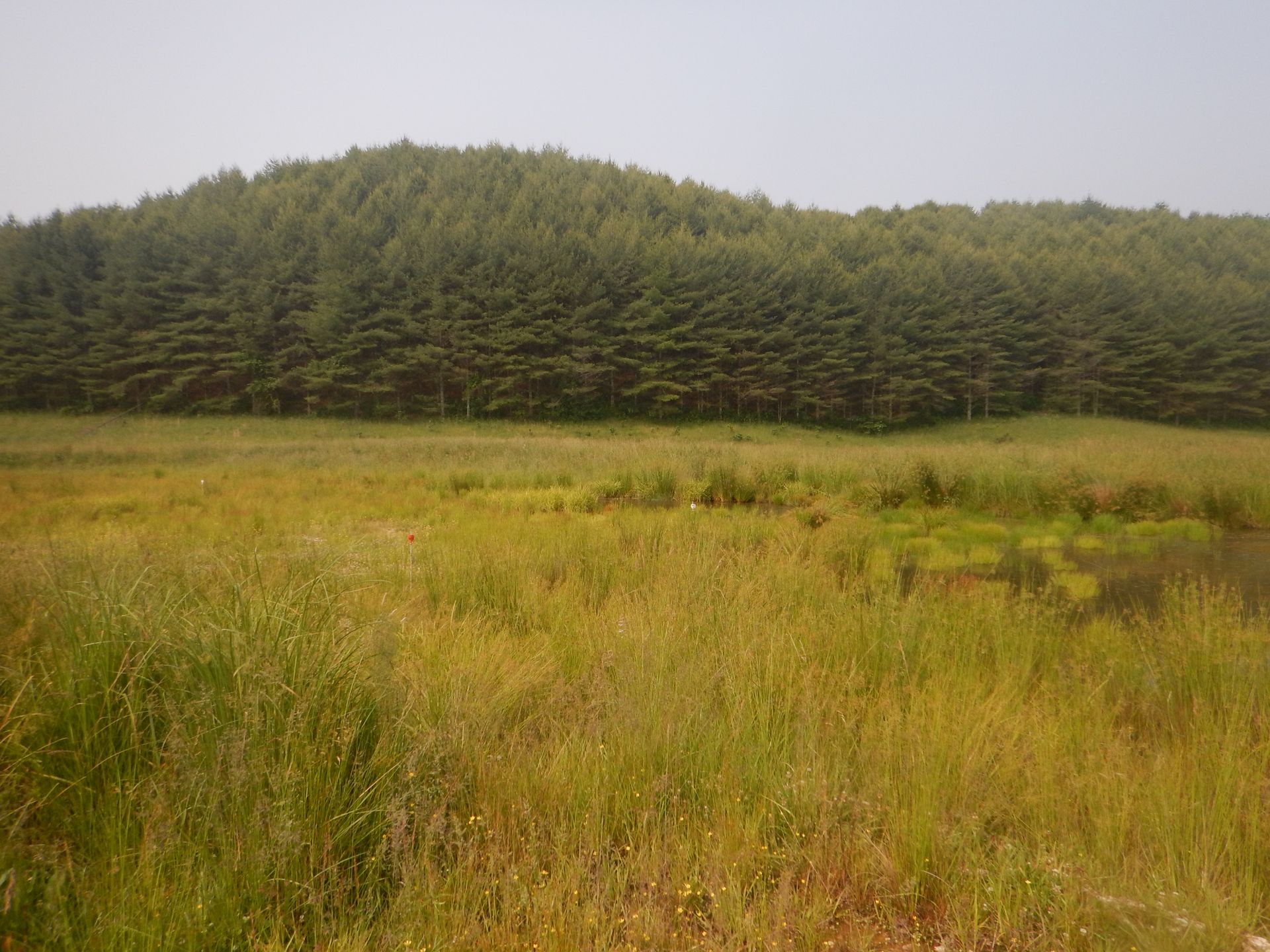
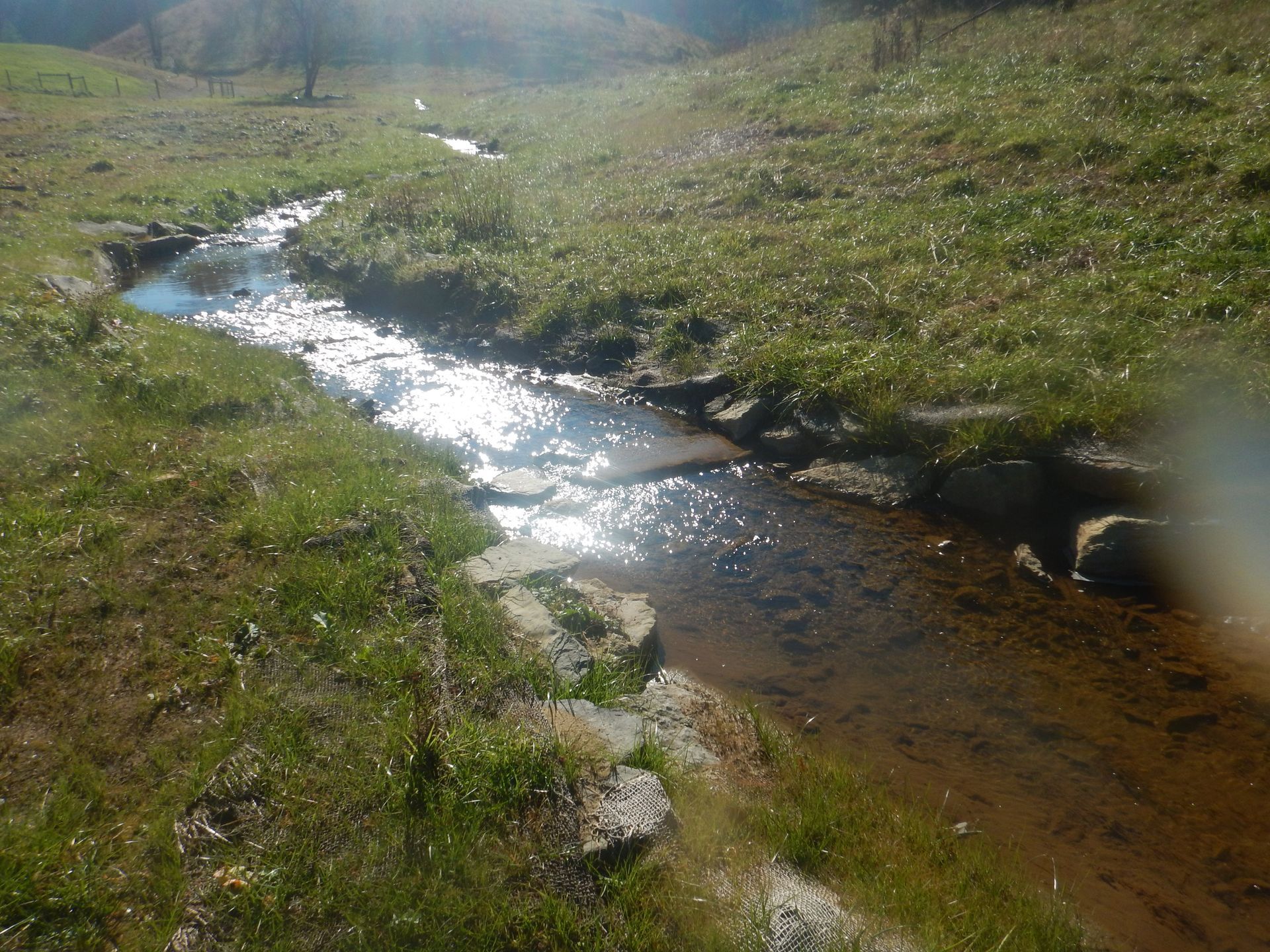
Benges Creek Mitigation Bank is 99 acres located along the Clinch River in Scott County, Virginia within the Clinch River Watershed (06010205). Historically, the site was utilized for livestock grazing and hay production. Benges Creek Mitigation Bank was approved by the Norfolk District of the U.S. Army Corps of Engineers in September of 2020. The mitigation plan includes stream and riparian restoration, enhancement and preservation, wetland reestablishment, and cattle exclusion.
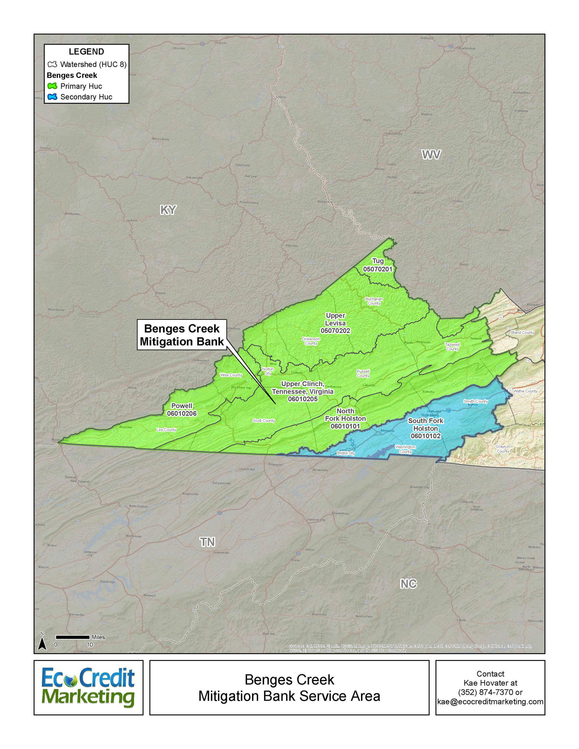
Benges Creek Mitigation Bank is approved to offset stream and wetland impacts in the bank’s service area. The primary service area includes the Clinch River (06010205), North Fork Holston River (06010101), Powell River (06010206), Tug Fork (05070201), and Big Sandy (05070202) watersheds. The secondary service area for Benges Creek includes the South Fork Holston River watershed (06010102). These watersheds include portions of Scott, Lee, Wise, Russell, Washington, and Tazewell Counties.
Determine if your project is located in the bank's service area. DOWNLOAD MAP PDF