Bartelso Bottoms Wetland Mitigation Bank
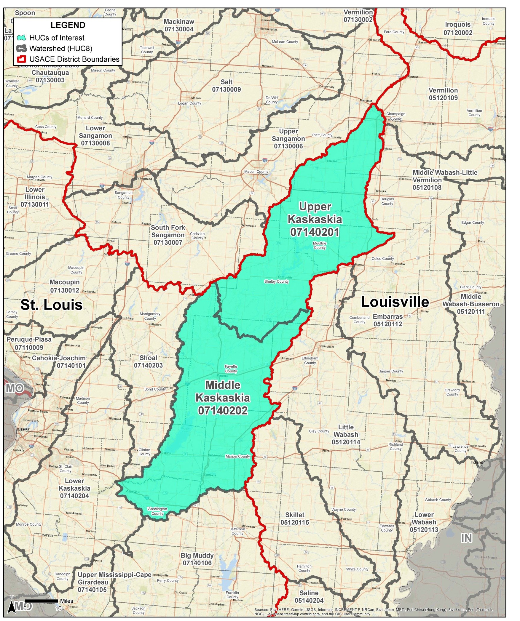
Upper Kaskaskia and Middle Kaskaskia
Upper Kaskaskia and Middle Kaskaskia
Clinton County
Wetland Credits
Bartelso Bottoms Wetland Mitigation Bank is a 97-acre site that consists of prior converted cropland directly connected to the Santa Fe Drainage Ditch within the floodplain of the Kaskaskia River in Clinton County, Illinois within the Middle Kaskaskia Watershed (HUC 07140202). The wetland mitigation plan includes the re-establishment of bottomland hardwood mast producing oak/hickory forested wetlands on land that is currently in agricultural production. Restoration of wetland areas will increase habitat opportunities for species that require or frequent shallow ephemeral wetlands. Bartelso Bottoms Wetland Mitigation Bank is pending approval by the U.S. Army Corps of Engineers St. Louis District for a potential of 80.42 wetland credits.
It is anticipated that Bartelso Bottoms Wetland Mitigation Bank will be approved to offset wetland impacts within the Middle Kaskaskia (HUC 007140202), and Upper Kaskaskia (HUC 07140201) watersheds. This includes all or portions of Bond, Champaign, Christian, Clinton, Coles, Douglas, Effingham, Fayette, Macon, Marion, Montgomery, Moultrie, Platt, Shelby, and Washington Counties.
Determine if your project is located in the bank's service area. DOWNLOAD MAP PDF


